Search and Rescue Report |
7/8/2006 |
| NARG members Andrew Bland, Andrew Burkholz, Bill Sullivan, and Aaron Currier joined Dr. William Orr of the Condon Museum at the University of Oregon, on a guided tour of Oregon's Oligocene shoreline on Saturday, July 8. The field trip near Scotts Mills was hosted by Dr. Ellen Bishop and the Oregon Paleo Lands Institute. Other participants included Fred Mosedale, Paula and Reid (9) Conlee, and Robin and Hannah (9) Brumbaugh-Cunningham.
Dr. Orr knows the Northwestern corner of the Willamette Valley well, having researched, mapped, and collected fossil material for publications over the past two decades. In fact, Dr. Orr is quite passionate about the legacy of his research in this area, and it shows in his enthusiasm as an educator and his choice to homestead along one of the streams that parallels what used to be the Oregon Coast 35 million years ago. Dr. Bishop, a self-described petrographer, also understands the Oligocene extensively. She professionally represents the John Day Formation near Fossil, Oregon, which is of course famous for terrestrial Oligocene ecosystems. Following introductions, a brief discussion of Oregon geology, and an overview of the days' itinerary, the group departed Brooks at 9am. The first stop was Lake Labish, which is now a fertile farmland rather than a body of water. During Pleistocene times, the area was part of the Willamette River until flood and glacial deposits filled it in, changing the course of the river further west. Over time the former river bed became a swampy grazing land for animals such as the great mammoths and mastodons, predatory dire wolves and sabertooth cats, and the peculiar giant ground sloths. Along with opportunities for food, there were circumstances for death resulting in a present-day gravesite for the prehistoric beasts. Although the age of the fossils is comparable to the La Brea tar pits, unlike La Brea it is not rich with predators. It reflects a more common pyramid ratio of predators to prey suggesting it was an area where many different animals likely died from various natural causes. Occasionally a freshly tilled field will produce a bone or two of one of these long-extinct inhabitants of the Willamette Valley. A second stop on the way to the Oligocene destination was a roadside view of Mt. Angel Butte, a fault "pop-up." As the Farallon Plate split during plate-tectonic subduction, the trailing end, now known as the Juan de Fuca plate, created the Columbia River Basalts (CRBs). Simultaneously, parallel faults running through the area provided an opportunity for allochthonous lava flows from the CRBs to squeeze up from below and form these "flower structures." Subsequently, tertiary soil deposits and plant growth have nearly disguised the fault. However, examining parallel geologic patterns in the surrounding farmlands shows evidence of this repetitive volcanic activity. Arriving in Scotts Mills, a small rural town in the western foothills of the Cascade Mountains, our group began an examination of the ancient shoreline environment, evident by the presence of various representative geologic features. The Scotts Mills Formation overlays the Little Butte Volcanics and is divided into three members -- Marquam, Abiqua Creek, and Coal Creek. Each member depicts the changing ecosystem during approximately 10 million years of the Oligocene period. Occasionally exposures of these members intertwine with each other as well. A short wade down Beaver Creek, a tributary to Butte Creek, brought the group to an exposure of the Marquam Member; the earliest layers of the Scotts Mills formation. From 35 to 32 million years ago, with the ancient seawater rich in calcium carbonate, limestone sedimentary deposits formed on volcanic mounds off shore. A prolific colonization of barnacles, along with other marine organisms, was preserved in the solidified sediments. This is evidence of a shallow, high-energy shoreline. Additionally, the underlying Little Butte Formation - represented by hard volcanic seastacks - poke up like fingers and were also colonized by animals. However, the fossils did not preserve well because of excessive wear and erosion. Just upstream from where Beaver Creek branches from Butte Creek, the Little Butte seastacks prominently stand out. It is not easy to imagine, however, standing along the shore looking out to sea with headlands towering behind. With Butte Creek running parallel to the ancient shore, deciduous trees mixed with massive old-growth conifers in every direction, and Pleistocene soil deposits masking much of the rock formations, time and geologic activity have altered the "beach" scene beyond typical recognition. For a closer look at the paleontological record of the Marquam Member, the group visited an early 20th Century basalt quarry mine. The quarry is now overgrown with large trees, which gave appreciated relief from the hot noon sun. Fossil specimens were found throughout the surrounding forest floor, including worm burrows, a brachiopod, pelecypods, barnacles, a large gastropod, and some carbonized driftwood. Dr. Orr explained that part of the fossiliferous formation was actually a siltstone made of volcanic ash, not limestone. He referred to the fossiliferous portion of the formation as a lag deposit. The water and its contents were "mixed up" and subsequently flocculated, or graded by mass as it settled. He pointed out a basalt sill parallel to the bedding plane. Not only had it caused "dipping down" and "sweeping up" of the above sedimentary layers, but it also "cooked" some of the fossils in the bottom layers, resulting in fossil remnants trapped in the basalt itself. After a quick lunch and further review of the geologic formations previously visited, one more stop was made to examine the Abiqua Member of the Scotts Mills Formation, which overlays the Marquam Member. Dr. Orr pointed out how a large crack had formed along the fault line and subsequent erosion by the stream resulted in a series of cascading waterfalls running through this unusual geologic feature. A nearby cliff wall exposed evidence of coastal sand dunes, much like those in Florence, Oregon today. Typically fossils are not found in these layers, nor is there silt. There is, however, clumps of calcareous concretions and almost-pure quartz sand, which to a geologist most surely describes a dune environment. The final member of the Scotts Mills is the Coal Creek, also known as Crooked Finger. The tour did not include a visit to an exposure. However, it was explained as the last of the layers to be deposited and actually contains coal deposits. In the recent past, the coal was commercially collected and burned to acquire potash for agricultural use. In summary, it takes a special knowledge of the area to recognize and identify the characteristics of an ancient shoreline. With a point in the right direction and an examination of the evidence, it is imaginable that it was a nice day at the beach... only 35 million years ago. |
Trip Pictures |
 |
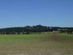
| Lake Labish |
 |
| Mt. Angel Butte |
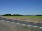 |
| Embryonic fault "pop_up" |
 |
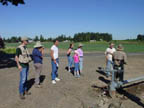
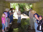
| Heading down to Beaver Creek |
 |
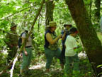
| Dr. Orr talking to the group |
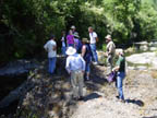 |
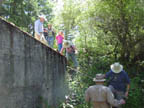
| Standing on one of the Sea Stacks |
 |
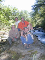
| Bill, Robin, Paula, Dr. Bishop, and Reid |
 |
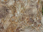
| Exposure of the Marquam Member |
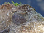 |
| Gastropod |
 |
| Brachiopod |
 |
| Fault line |
 |
| Preshistoric coastal sand dunes |
 |
| Bill, Andrew, Andrew, Aaron |
| ©2004 NARG - North America Research Group |